| Oggetto |
Almone, piccolo fiume dell’agro romano che attraversa il Parco regionale dell’Appia Antica. |
| Luogo |
Golf Club Acquasanta, Roma |
| Data |
Maggio-Giugno 2014 |
| Partnerships |
IANUS per rilievo laser scanner |
| Committente |
Arch. Pietro Laureano - IPOGEA |
| Finalità |
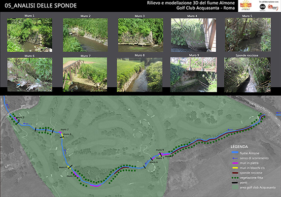
Rilievo propedeutico a progetto di consolidamento delle sponde |
| Descrizione |
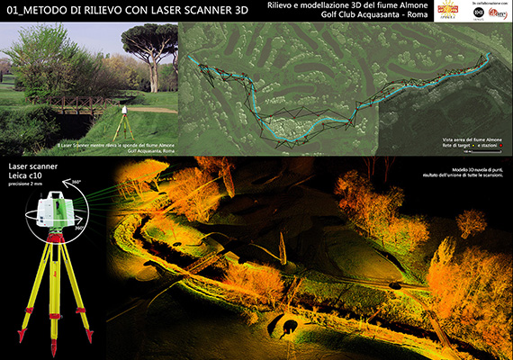
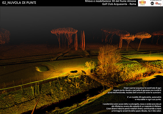
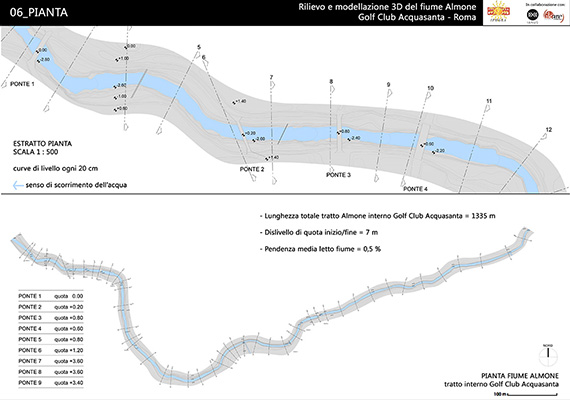
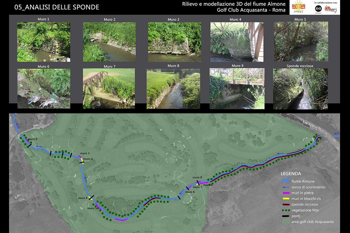
Rilievo laser scanner delle sponde del fiume Almone nel tratto che scorre all’interno del Golf Club Acquasanta, Roma.
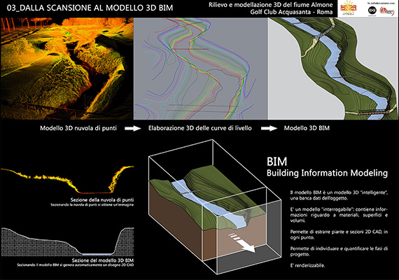
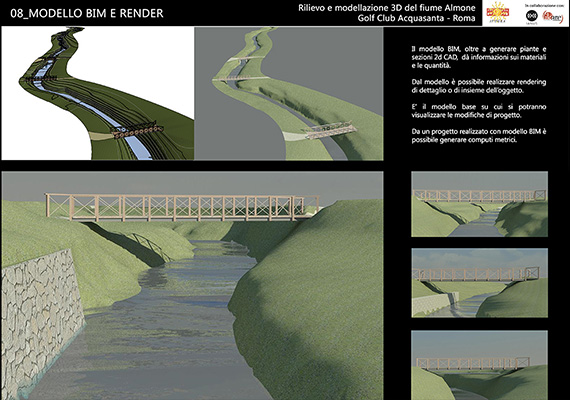
Reverse modeling: dalla nuvola di punti al modello 3D BIM (Building Information Modeling), ovvero realizzazione di un modello 3D interrogabile, completo di tutte le informazioni metriche e materiche e da cui poter estrarre elaborati CAD 2D (piante e sezioni) e rendering.
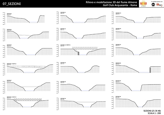
Restituzione del rilievo in scala 1:500 della planimetria generale (con curve di livello ogni 20 cm), e delle sezioni delle sponde in scala 1:200 ogni 25 m su un tratto di 1330 m, per un totale di 50 sezioni. |
